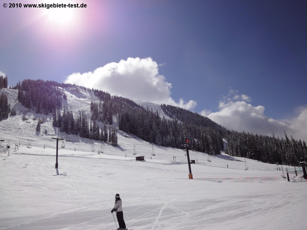
The Ski Resort
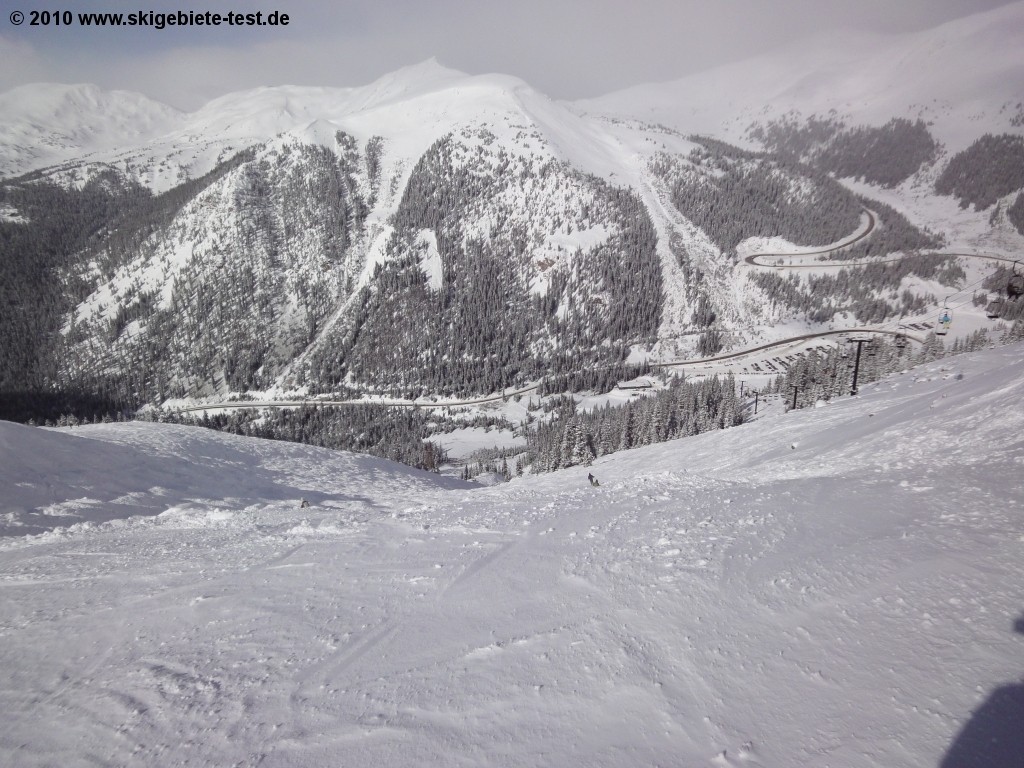
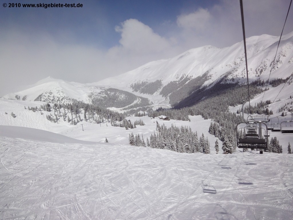
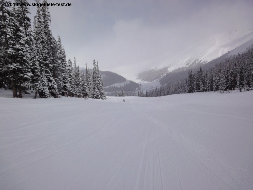
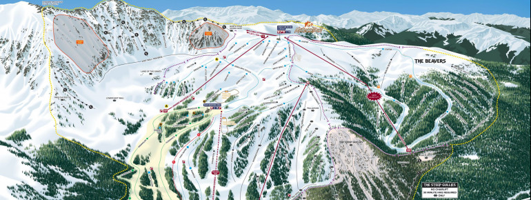
Arapahoe Basin is among Colorado's biggest ski resorts and offers skiers more than 109 miles of groomed and ungroomed trails. When snow conditions are good, it opens mid-October and season never ends before June. Perfect for sun skiing lovers!
Everyone in your party will find doable terrain with 10 percent beginner runs, 30 percent intermediate downhills and with 60 percent dedicated to advanced and expert skiers. The latter especially will appreciate the variety.
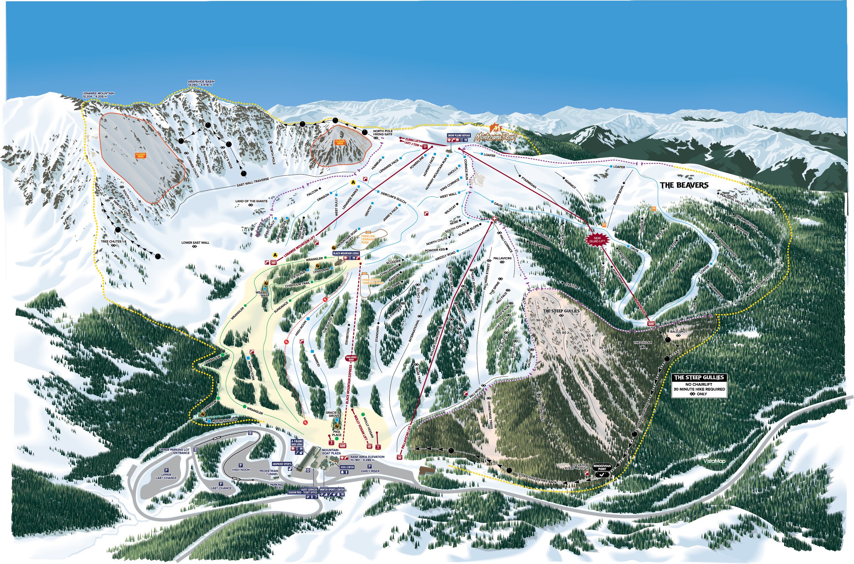
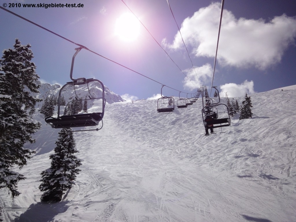
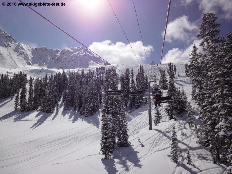
The 68-year-old legend offers skiing on a high altitude. Half of the mountain is above timberline and features open bowl skiing and boarding. Starting from the base, beginners and intermediates are best off taking the High Speed Quad Black Mountain Express to reach half mountain. Several green and blue trails expect you up here. Heading left you can also find a ton of short blacks that take you through the woods and take tree skiing to another level.
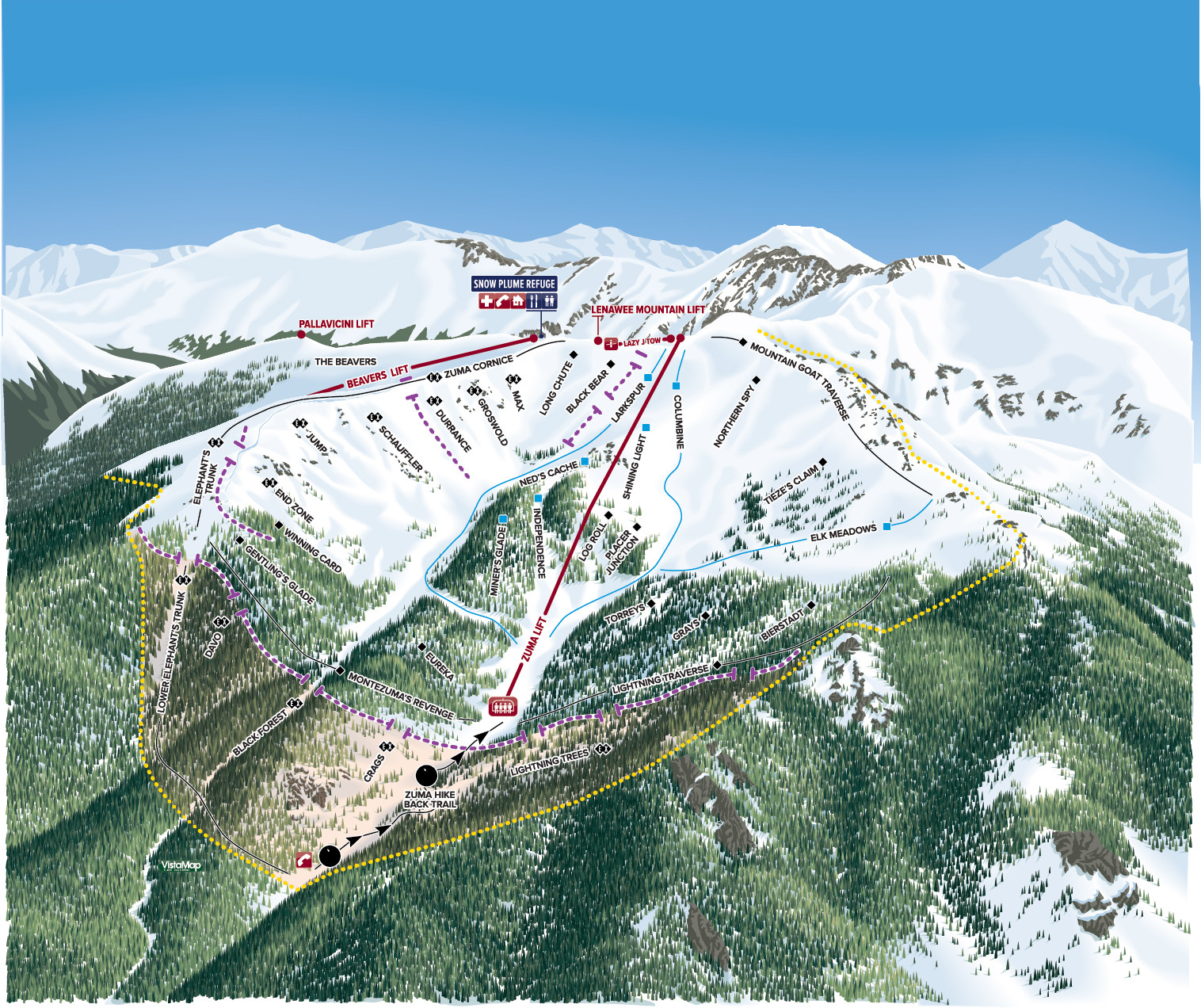
If you ski the green 'Wrangler', you'll get to Lenawee Mountain lift. This one gives you access to the Montezuma Bowl, which has a vertical rise of over 13,000 feet! The Bowl is serviced by the Zuma lift, Lenawee Mountain lift and Black Mountain Express. Strong skiers in search of steeper, ungroomed trails and light powder will find what they're looking for. There are glades, moguls and bowls just waiting to please adventurous skiers.
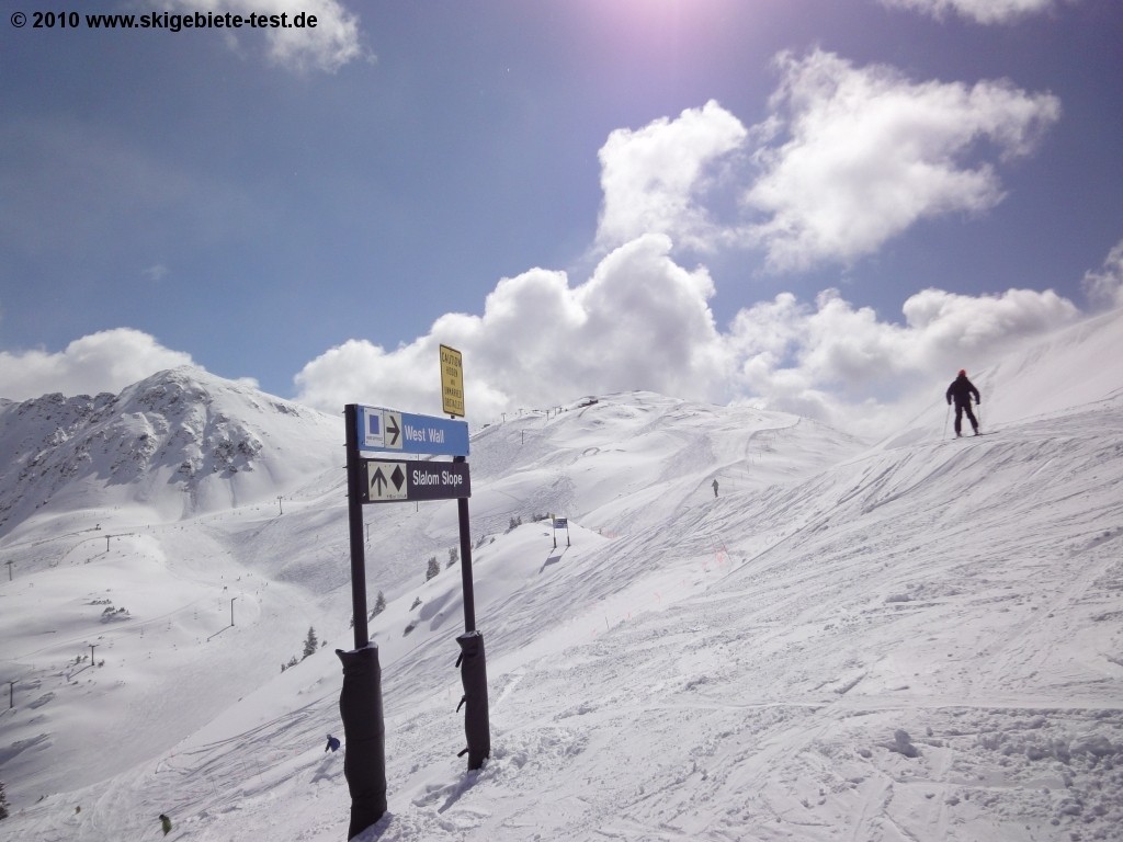
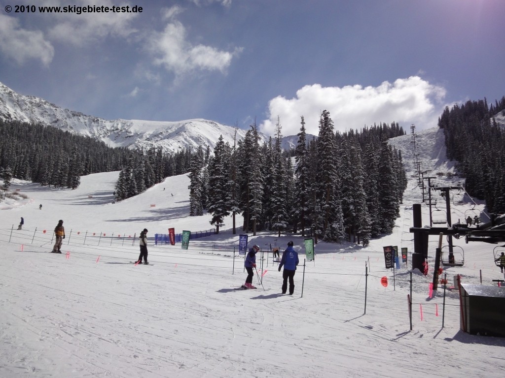
In the front you'll find blues in abundance. Another option is to switch from the High Speed Quad to the Norway lift at mid-mountain. Advanced skiers take Pallavicini lift to find really challenging descends. 'North Glade', 'My Chute' which later merges with 'International' and 'Pali Main Street' just to name a few. First-time skiers should hit the Learning area at Molly Hogan lift. You'll see it from the valley.
Two terrain parks await you at Arapahoe Basin. The High Speed Quad Black Mountain Express gives you a ride to High Divide Terrain Park. It's one of the best freestyle parks around. It features artificial and natural obstacles to guarantee a great diversity. The progression park boasts mostly small to medium features. The Treeline Terrain Park is situated at the foot of the Norway lift and makes the freestyle offer a perfect one. Among other highlights, it offers an A-Frame rail, a Picnic Table box and a Down-flat-down rail.
Interesting facts
- Elevated between 3,285 m and 3,978 m, the Ski Resort is among the 3 highest elevated Ski Resorts in the USA. The vertical drop from summit to base is 692 m. The average difference in altitude between base and summit of Ski Resorts in the USA is 374 m. Most runs are therefore relatively long.
- During the season the average snow depth at Arapahoe Basin is 145 cm. Snow coverage is usually best during April, offering an average base depth of 163 cm. Therefore Arapahoe Basin is among the 10 ski Resorts with best snow conditions in the USA.
- Arapahoe Basin features 103 sunny days on average per season. The average for all ski Resorts in the USA is 97 sunny days. May is the sunniest month with an average of 20 sunny days.
Snow Safety & Snowmaking
On Mountain Dining
Quick pick me up or a long lunch break? You can have both at A-Basin. Six restaurants leave you tempted for a break from skiing.
There is really something about admiring the terrain you just skied with a cold beverage in your hand. Black Mountain Lodge is one of the places where you can do just that. They specialize in hearty American food like sandwiches, burgers and salads. The Perch, located on the 2nd floor of the A-Frame is a great sun deck to enjoy the breathtaking views of the surroundings.
The Legends Cafe in the classic A-Frame serves typical, tasty mountain fare. To try something new you can head to Pacific Rim Asian Station. Located at the north end of the A-Frame base lodge you can look for Coffee Corner. Every coffee specialty you've ever dreamed as well as frozen treats and baked goods are on the menu.
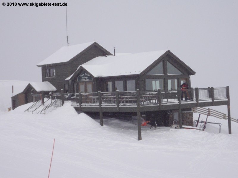
6th Alley Bar& Grille is also great for apres ski. Here you can sit back, get together with friends and family and refuel with drinks as well as great food. Last but not least, the Snow Plume Refuge is a great option for a stop. Here you can even bring your own food and use the grill shacks to prepare it yourself.
Must-Ski Runs
One of its signature runs, Pallavicini, is one of Colorado's longest and steepest trails.
Longest Runs
Most Difficult Runs
Videos
Activities
Make the most out of your stay, even if you aren't into skiing and boarding. Summit County has a lot to offer. Sledding is a big deal here, so for a few bucks you can buy yourself a sleigh or rent one at the countless runs in the area. You can check out Carter Park in Breckenridge, the Hoosier Pass, or Frisco Adventure Park
If you prefer cross-country skiing you'll find tracks everywhere. Silverthrone Nordic Center is the only one without an entrance fee, though. Ice fishing, Ice skating and romantic horse sleigh rides are also available, just outside of Arapahoe Basin.
Every season, especially during winter, you'll notice that a lot of festivities and events are going on. In the fall, when the ski resort is already open, you can enjoy the Fall Concert Series. Every December Santa comes to visit A-Basin and the Rise and Shine Rando Series throughout the skiing season is almost legendary.
The two spas in Breckenridge aren't too far away either, so if you need a massage after along day on the slopes you'll find what you're looking for at Simply Massage or Harmony Health and Massage.
Après-Ski and Nightlife
Denver has all the nightlife you can imagine. But even if you're staying in A- Basin and the Summit County, you can end up having the best parties of your life. The 6th Alley Bar& Grille is not just a great stop for lunch, but also one of the best apres ski hangouts. Through the one-million dollar renovation it got a total make over. Located in the A-basin base lodge it has a convenient location. From here you have an awesome view of the slopes while you enjoy a beer or two at night time.
The Snowside parking lot at the base turns into "the beach" in the afternoon. BBQs, deck chairs and beer make it to the perfect apres ski place outside.
Dining and Restaurants
The Moonlight Dinner Series is definitely a must for all foodies. Executive Chef Christopher Rybak brings food from all cultures and regions in the world to the mountains. It takes place on Saturdays during the full moon cycle. Examples are 'A night in Bavaria', 'New Year's Eve in the Mountains', 'A night in Spain' or 'A night in India'.
The Summit County has a ton of fine dining restaurants to offer. Breckenridge invites visitors for example to the 'Ember' restaurant, the 'Blue Spruce Inn' and the 'Lord Gore Restaurant'. Denver pretty much boasts restaurants from all over the world, so if you're looking for something extravagant you can make the drive there.
Getting here
From Denver: The resort is a 96 mile drive west from Denver International Airport via I-70 west. Take I-70 until exit 205, then change onto Highway 6. Or, choose the 68 mile scenic route from Denver by taking I-70 west to exit 216. The Highway 6 takes you after a 8 mile drive to A-Basin.
From Colorado Springs: 115 miles away you start driving on the 25 north to C-470 west. After, take I-70 and exit at Silverthrone. From here you can follow the directions coming from Denver.
By Public Transportation:
Summit County offers a free bus service from all locations around Summit County. Contact Resort Express for direct service from Denver International Airport to lodging within Summit County.
Denver International Airport has daily flights arriving and departure to international airports. An other option is are the Colorado Springs and Vail/Eagle Airports.