The Ski Resort
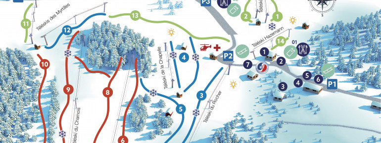
About 10 km southeast of Schirmeck in the province of Alsace, the Champ du Feu rises 1099 meters into the air and happens to be the highest landmark in the Central Vosges. This beautiful mountain offers 90 km of cross country ski tracks and 18 km of alpine ski trails which are made accessible by 10 lift facilities!
A rental ski shop is located on the mountain as well as several ski schools. The beautiful winter hiking trails offer diversion from downhill or cross country skiing and can be discovered by snowshoes or by foot!
Interesting facts
- The vertical drop from summit to base is 300 m. The average difference in altitude between base and summit of Ski Resorts in France is 819 m. Runs and slopes are therefore relatively short. The highest point of the track is 1,100 m above sea level.
- The day pass at Champ du Feu is €23 making it one of the 3 cheapest ski Resorts in Lorraine.
- Snow coverage is usually best during December, offering an average snow depth of 27 cm at summit elevation and 10 cm at the base.