
Today's weather at Dachstein Glacier • 9 Days Forecast
Dachsteingletscher Summit

© GeoSphere Austria
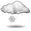
snowfall
1 °C
min -3 °C
max 1 °C
max 1 °C
Today, 1 Jun 2024: Snowfall again and again. The strongest snowfall will occur around noon.
Current conditions
Morning
 light snowfall
-2 °CRain: 1 l/m2Fresh snow: 1 cmWind direction: North-WestWind speed: 11 km/hStorm risk: 10 %Fog risk: 85 %Rain risk: 1 %Noon
snowfall
0 °CRain: 7 l/m2Fresh snow: 6 cmWind direction: South-WestWind speed: 14 km/hStorm risk: 5 %Fog risk: 90 %Rain risk: 7 %Evening
light snowfall
0 °CRain: 0 l/m2Fresh snow: 1 cmWind direction: WestWind speed: 14 km/hStorm risk: 0 %Fog risk: 85 %Rain risk: 0 %
Weather Stations nearby
- Dachsteingletscher Summit
- 2,700 m
- Dachsteingletscher Valley
- 2,296 m
Advertisement
Advertisement